
ISS029-E-005064 (16 Sept. 2011) --- Backdropped by Earth's horizon and the blackness of space, a docked Russian Soyuz spacecraft is featured in this image photographed by an Expedition 29 crew member on the International Space Station.
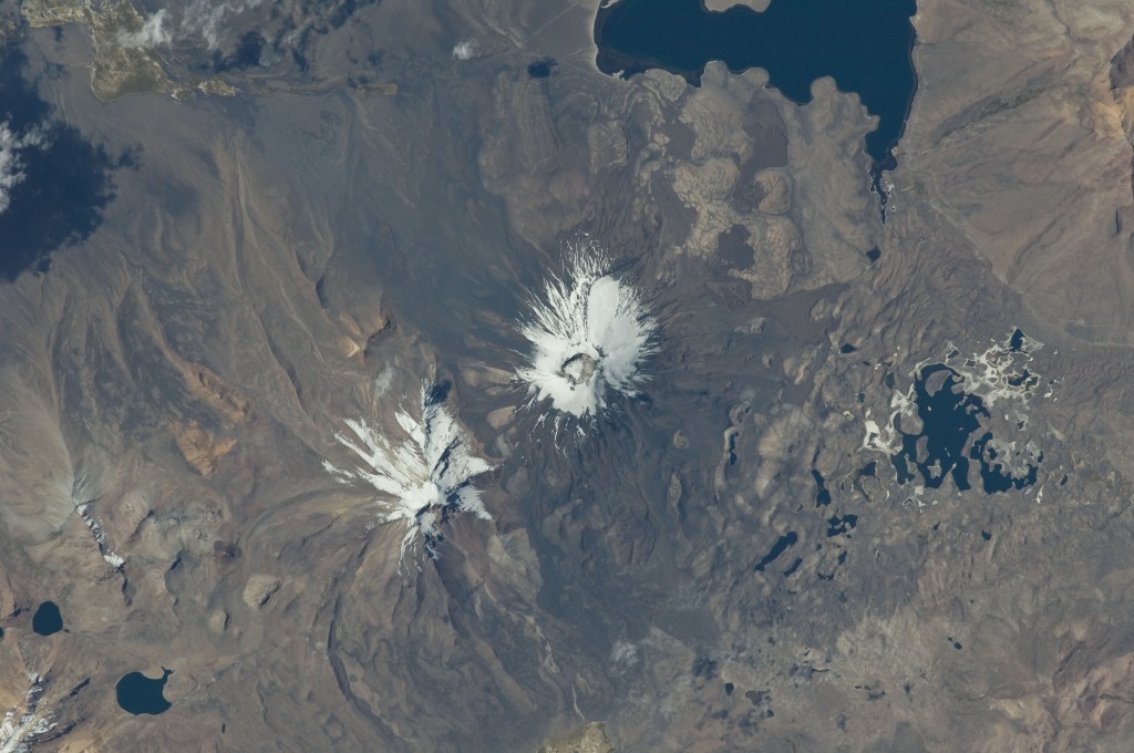
ISS029-E-020003 (7 Oct. 2011) --- Parinacota Volcano in the Chile-Bolivia border region, South America is featured in this image photographed by an Expedition 29 crew member on the International Space Station. Volcan Parinacota ("flamingo lake" in the regional Aymara language) is a potentially active stratovolcano located on the Altiplano, a high plateau situated within the Andes Mountains of west-central South America. While no direct observations of eruptive activity are recorded, surface exposure age-dating of lava flows suggests that activity occurred as recently as 290 AD approximately 300 years, according to scientists. Local Aymara stories also suggest that the volcano has erupted during the past 1,000 years. This detailed photograph highlights the symmetrical cone of Parinacota, with its well-developed summit crater (elevation 6,348 meters above sea level) at center. Dark brown to dark gray surfaces to the east and west of the summit include lava flows, pyroclastic deposits, and ash. A companion volcano, Pomerape, is located across a low saddle to the north -- scientists believe this volcano last erupted during the Pleistocene Epoch (extending from approximately 3 million to 12,000 years ago). The summits of both volcanoes are covered by white permanent snowpack and small glaciers. Together, the two volcanoes form the Nevados de Payachata volcanic area. Eruptive activity at Parinacota has directly influenced development of the local landscape beyond the emplacement of volcanic deposits -- approximately 8,000 years ago the western flank of the volcano collapsed, creating a debris avalanche that traveled 22 kilometers to the west. This debris avalanche blocked drainages, leading to the formation of Lake Chungara to the south (upper right). The uneven, hummocky surface of the debris avalanche deposit provides ample catchments for water, as evidenced by the numerous small ponds and Cotacotani Lake to the west.
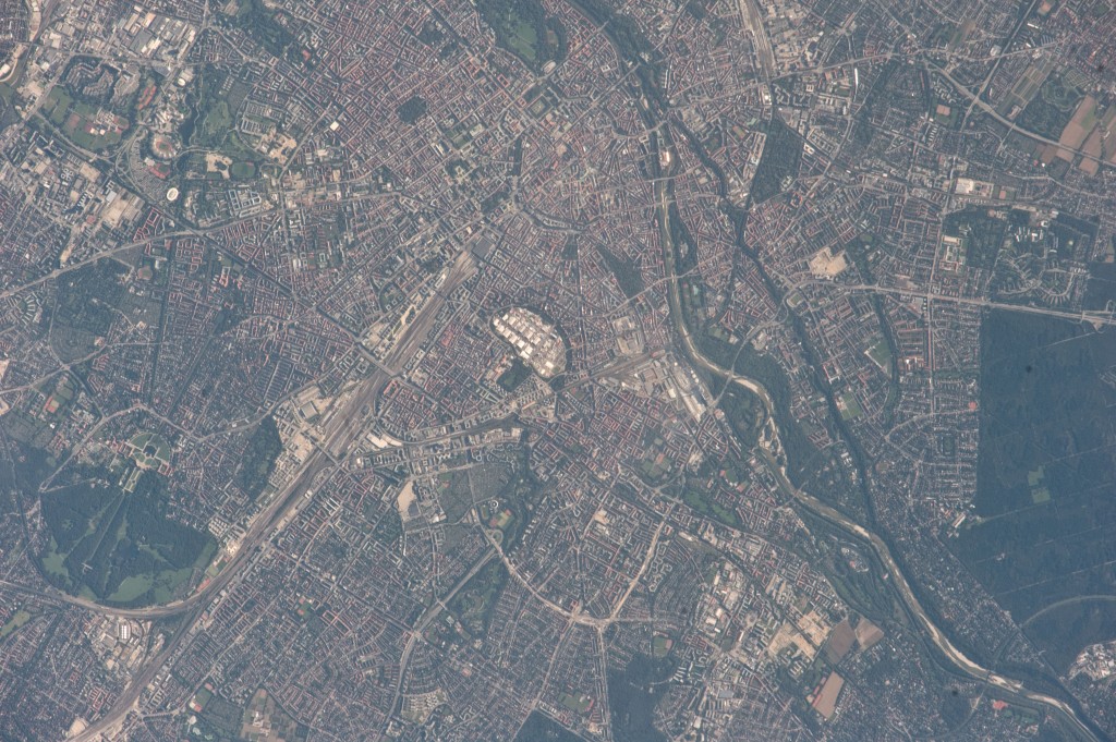
ISS029-E-009232 (24 Sept. 2011) --- This image of the central area of Munich, Germany was photographed from approximately 220 miles above Earth by one of the Expedition 29 crew members onboard the Earth-orbiting International Space Station at 08:31:59 GMT, Sept. 24, 2011. Theresienwiese, site of Oktoberfest, is in the center of the metropolitan area. The Isar River is clearly visible running along the right hand side of the photograph. A 1200-mm focal length was used to capture the image.
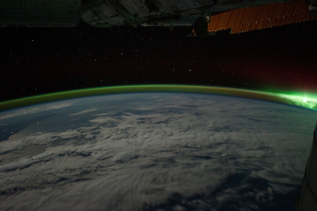
ISS029-E-006143 (18 Sept. 2011) --- This is one of a series of night time images photographed by one of the Expedition 29 crew members from the International Space Station. It features Aurora Australis and parts of the southeastern Indian Ocean. Nadir coordinates are 40.57 degrees south latitude and 112.15 degrees east longitude. It was photographed at 15:01:50 GMT, Sept. 18, 2011.
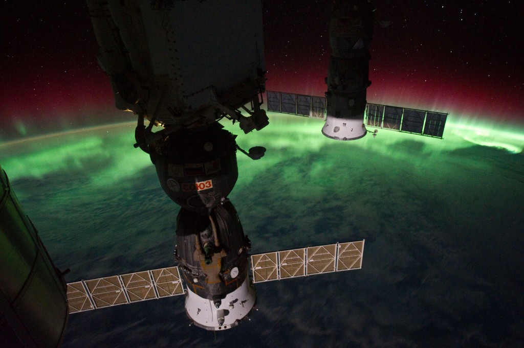
ISS029-E-008433 (17 Sept. 2011) --- This is one of a series of night time images photographed by one of the Expedition 29 crew members from the International Space Station. It features Aurora Australis, seen from a point over the southeast Tasman Sea near southern New Zealand. The station was located at 46.65 degrees south latitude and 169.10 degrees east longitude.
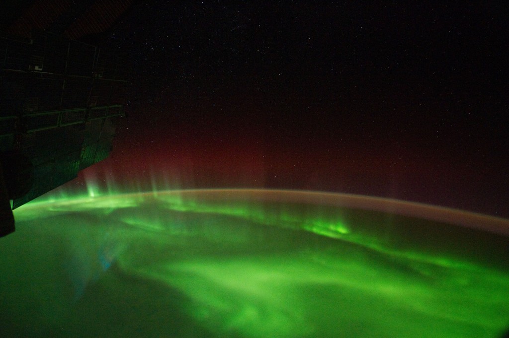
ISS029-E-007500 (18 Sept. 2011) --- This is one of a series of night time images photographed by one of the Expedition 29 crew members from the International Space Station. It features the Aurora Australis, airglow and parts of the southeastern Indian Ocean. Nadir coordinates are 50.66 degrees south latitude and 137.70 degrees east longitude.
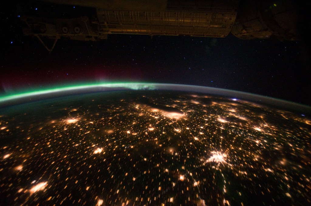
ISS029-E-012564 (29 Sept. 2011) --- The Midwestern United States at night with Aurora Borealis is featured in this image photographed by an Expedition 29 crew member on the International Space Station. The night skies viewed from the space station are illuminated with light from many sources. For example, the Midwestern United States presents a night-time appearance not unlike a patchwork quilt when viewed from orbit. The artificial light from human settlements appears everywhere with a characteristic yellow tinge in this photograph. But green light of the Aurora Borealis also appears strongly in this view (top left)—even seeming to be reflected off Earth's surface—in Canada—beneath the aurora. A small white patch of light is almost certainly lightning from a storm on the East coast (top right). Part of the International Space Station appears across the top of the image. This photograph highlights the Chicago, IL, metropolitan area as the largest cluster of lights at center, next to the dark patch of Lake Michigan. The other largest metropolitan areas include St. Louis, MO (lower right), Minneapolis--St. Paul, MN (left) and the Omaha--Council Bluffs region on the Nebraska--Iowa border (lower left). City light clusters give an immediate sense of relative city size; demographers have used night time satellite imagery to make estimates of city populations, especially in the developing world where city growth can be very rapid. The U.S. northeast seaboard lies in the most oblique (meaning viewed at an angle) part of the image at top right, just beyond the Appalachian Mts., a dark winding zone without major cities. Scales change significantly in oblique views: Omaha is only 200 kilometers from Des Moines, but appears roughly the same distance from Minneapolis—which is actually 375 kilometers to the north of Des Moines. In addition to the major metropolitan areas, the rectangular NS/EW-oriented pattern of townships is clearly visible in the rural, lower left part of the image. This pattern instantly gives the sense of north orientation (toward the top left corner) and is a distinctive characteristic of the United States, so that ISS crew members can quickly know which continent they are flying over even at night. In contrast to the regular township pattern, interstate highways converge on St. Louis (e.g. Hwy 44), Chicago and other large cities, much like wheel spokes around a central hub. Rivers—major visual features in daylight—become almost invisible at night. The course of the Mississippi River appears as a slightly meandering zone from Minneapolis through St. Louis (dashed line)—the river course continues out of the lower right corner of the image.
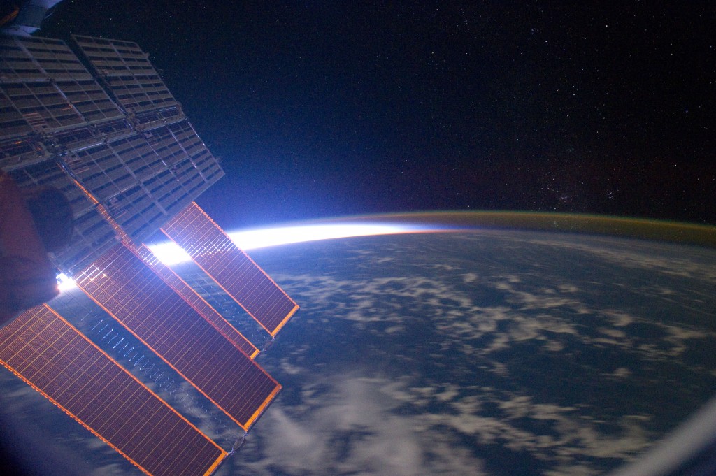
ISS029-E-006857 (18 Sept. 2011) --- This is one of a series of night time images photographed by one of the Expedition 29 crew members from the International Space Station. It features airglow, Earth's terminator and parts of the Central Pacific Ocean. Nadir coordinates are 10.41 degrees north latitude and 169.70 degrees west longitude.

ISS029-E-031143 (15 Oct. 2011) --- One of the Expedition 29 crew members aboard the International Space Station recorded this oblique view showing the Mediterranean Sea area, including parts of Turkey, the Nile River and the river's delta, and the Sinai Peninsula, on Oct. 15, 2011. At first look, the image appears to have been photographed in daylight, but actually it was taken at 01:01:26 GMT. Some areas of the photo like the river and river delta appear as the brightest areas because of either man-made lighting (mostly incandescent) or man-made lighting reflected off nearby surfaces. The other areas appear to be illuminated naturally by moonlight, starlight, or back-scattered light from the atmosphere. A 20-mm focal length was used to record the image.

ISS029-E-029257 (18 Oct. 2011) --- This is one of a series of night time images photographed by the Expedition 29 crew from the International Space Station. It features Southeastern United States centered near Atlanta. The Florida peninsula is visible under clouds (lower right).

ISS029-E-021987 (2 Oct. 2011) --- This is one of a series of night time images photographed by one of the Expedition 29 crew members from the International Space Station. It features Central and Eastern Europe, extending from the Netherlands to Hungary and Italy to northern Poland. Overall, the view includes the Netherlands, Italy, Germany, Poland, and Hungary. When the photo was taken on Oct 2, 2011, the station was over Corsica at 43.18 degrees north latitude and 9.95 degrees east longitude.

ISS029-E-030079 (15 Oct. 2011) --- One of the Expedition 29 crew members aboard the International Space Station recorded this oblique view showing Eastern Europe at night. The image includes Budapest, Hungary in the foreground (center left) and Kiev, Ukraine in the distance (top center). A 50-mm focal length was used to record the image.
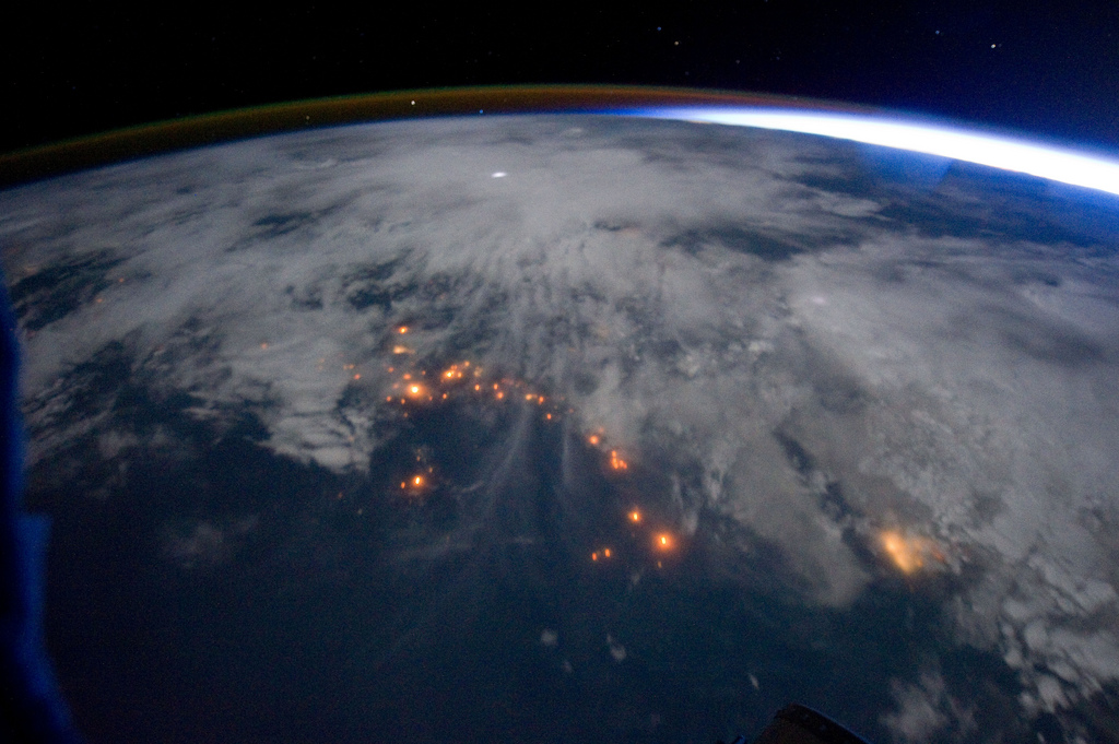
ISS029-E-005343 (16 Sept. 2011) ---- One of the Expedition 29 crew members aboard the International Space Station, approximately 220 miles above Earth, took this night time picture showing clouds, lightning, airglow, Earth's terminator and lights of civilization along the central west coast of Africa. Nadir coordinates are 9.04 degrees south latitude and 10.18 degrees east longitude.
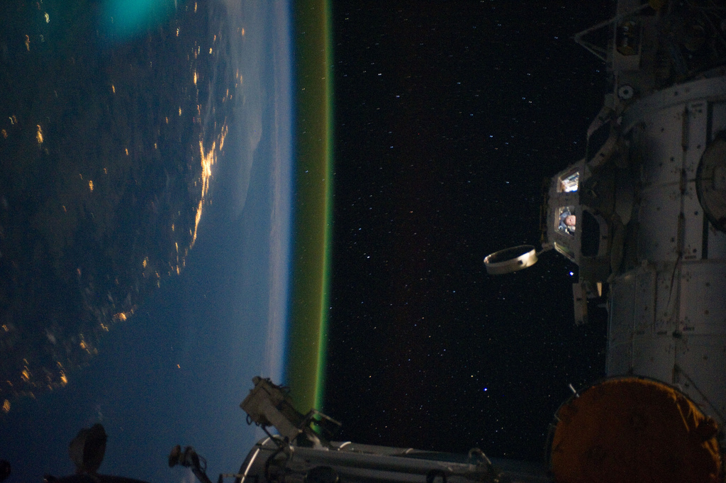
ISS028-E-050184 (15 Sept. 2011) --- This unique photographic angle, featuring the International Space Station’s Cupola and crew activity inside it, other hardware belonging to the station, city lights on Earth and airglow was captured by one of the Expedition 28 crew members. The major urban area on the coast is Brisbane, Australia. The station was passing over an area southwest of Canberra.

ISS028-E-009979 (27 June 2011) --- The Massachusetts coastline is featured in this image photographed by an Expedition 28 crew member on the International Space Station. The Crew Earth Observations team at NASA Johnson Space Center sends specific ground targets for photography up to the station crew on a daily basis, but sometimes the crew takes imagery on their own of striking displays visible from orbit. One such display, often visible to the ISS crew due to their ability to look outwards at angles between 0 and 90 degrees, is sunglint on the waters of Earth. Sunglint is caused by sunlight reflecting off of a water surface—much as light reflects from a mirror—directly towards the observer. Roughness variations of the water surface scatter the light, blurring the reflection and producing the typical silvery sheen of the sunglint area. The point of maximum sunglint is centered within Cape Cod Bay, the body of water partially enclosed by the "hook" of Cape Cod in Massachusetts (bottom). Cape Cod was formally designated a National Seashore in 1966. Sunglint off the water provides sharp contrast with the coastline and the nearby islands of Martha's Vineyard and Nantucket (lower left), both popular destinations for tourists and summer residents. To the north, rocky Cape Ann extends out into the Atlantic Ocean; the border with New Hampshire is located approximately 30 kilometers up the coast. Further to the west, the eastern half of Long Island, New York is visible emerging from extensive cloud cover over the mid-Atlantic and Midwestern States. Persistent storm tracks had been contributing to record flooding along rivers in the Midwest at the time this image was taken in late June 2011. Thin blue layers of the atmosphere, contrasted against the darkness of space, are visible extending along the Earth's curvature at top.
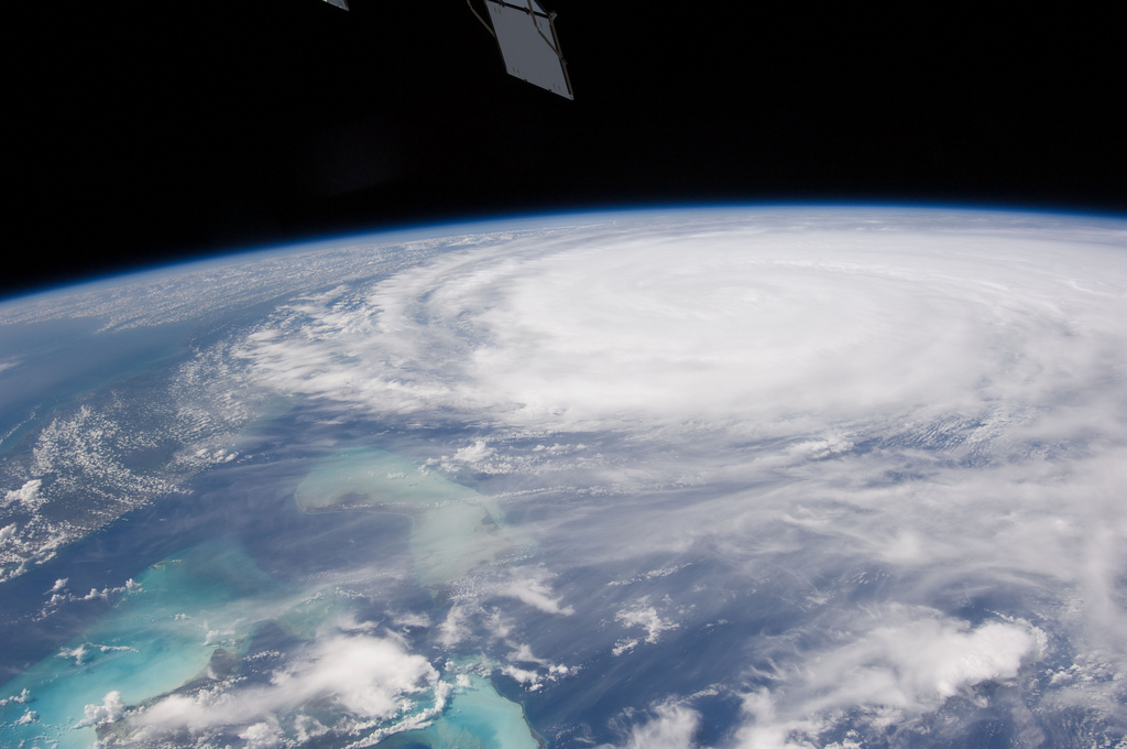
ISS028-E-034423 (26 Aug. 2011) --- This image of Hurricane Irene on Aug. 26 was photographed by one of the Expedition 28 crew members on board the International Space Station. The eye was at 31.2 degrees north latitude and 77.5 degrees west longitude moving due north 360 degrees at 14 miles per hour. Winds were 98 miles per hour, gusting to 120.8 miles per hour. Part of Florida's peninsula can be seen on the left and the northwest Bahamas are in lower left. One of the station's trusses' radiator panels is at the upper center edge of the frame.
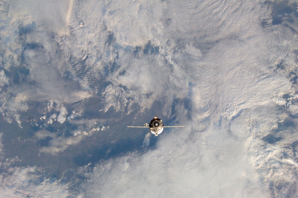
ISS029-E-036139 (2 Nov. 2011) --- An unpiloted ISS Progress resupply vehicle approaches the International Space Station, carrying 1,653 pounds of propellant, 110 pounds of oxygen, 926 pounds of water and 3,108 pounds of maintenance gear, spare parts, experiment hardware and resupply items for the residents of the space station. Progress 45 docked to the station's Pirs docking compartment at 7:41 a.m. (EDT) on Nov. 2, 2011.
