The following maps and satellite photos depict refugee camps in Turkey and Jordan and provide statistics regarding the displacement of persons as the result of the conflict in Syria. The first map was created by the U.S. State Department Humanitarian Information Unit and provides statistics on displaced persons and locations of refugee camps as a result of the Syrian conflict. The other photos are from satellite imagery analyzed by the U.N. Operational Satellite Applications Programme (UNOSAT) focusing on the growth of specific refugee camps in Turkey and Jordan. To follow future updates, see U.S. State Department Humanitarian Information Unit Middle East products page and UNOSAT’s contributions to ReliefWeb on Syrian refugee camps.
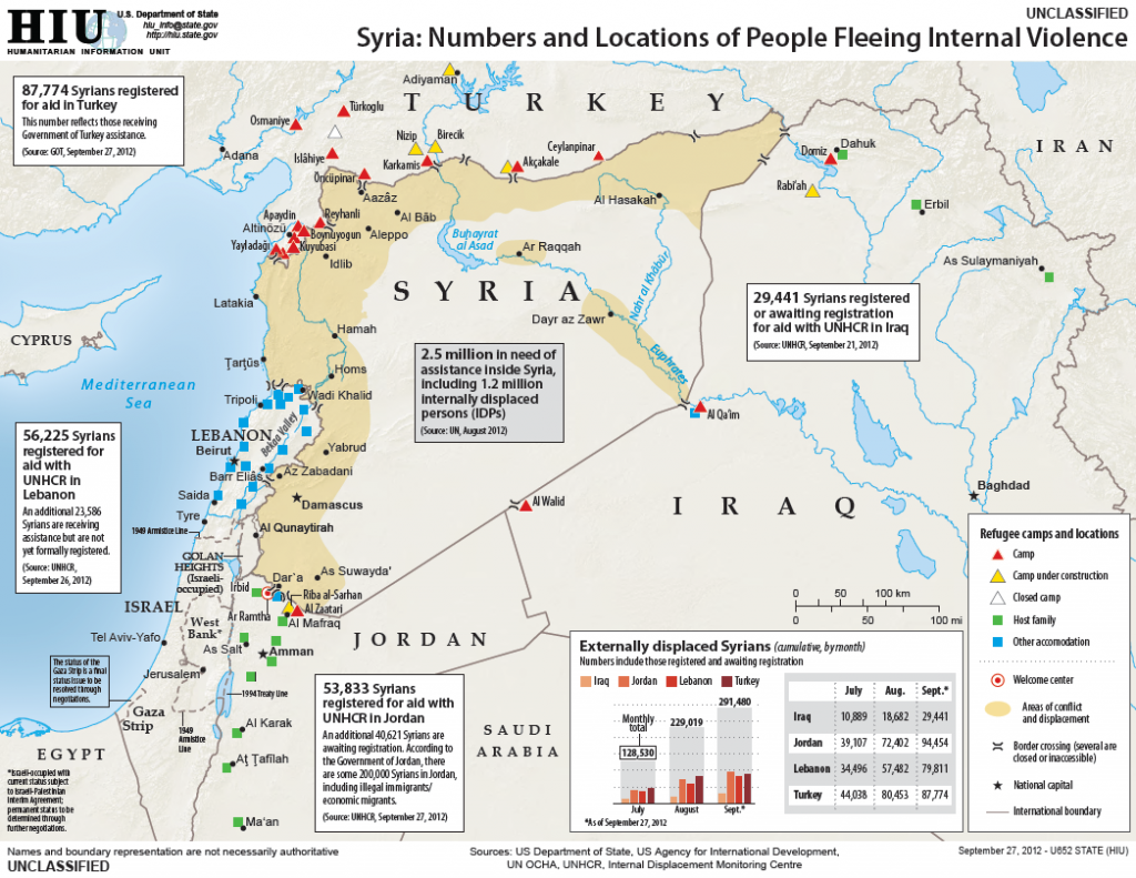
U.S. State Department Humanitarian Information Unit map of displaced persons from the Syrian conflict as of September 27, 2012.
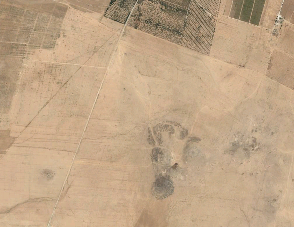
Al-Zaatari Camp Mafraq Governorate, Northern Jordan
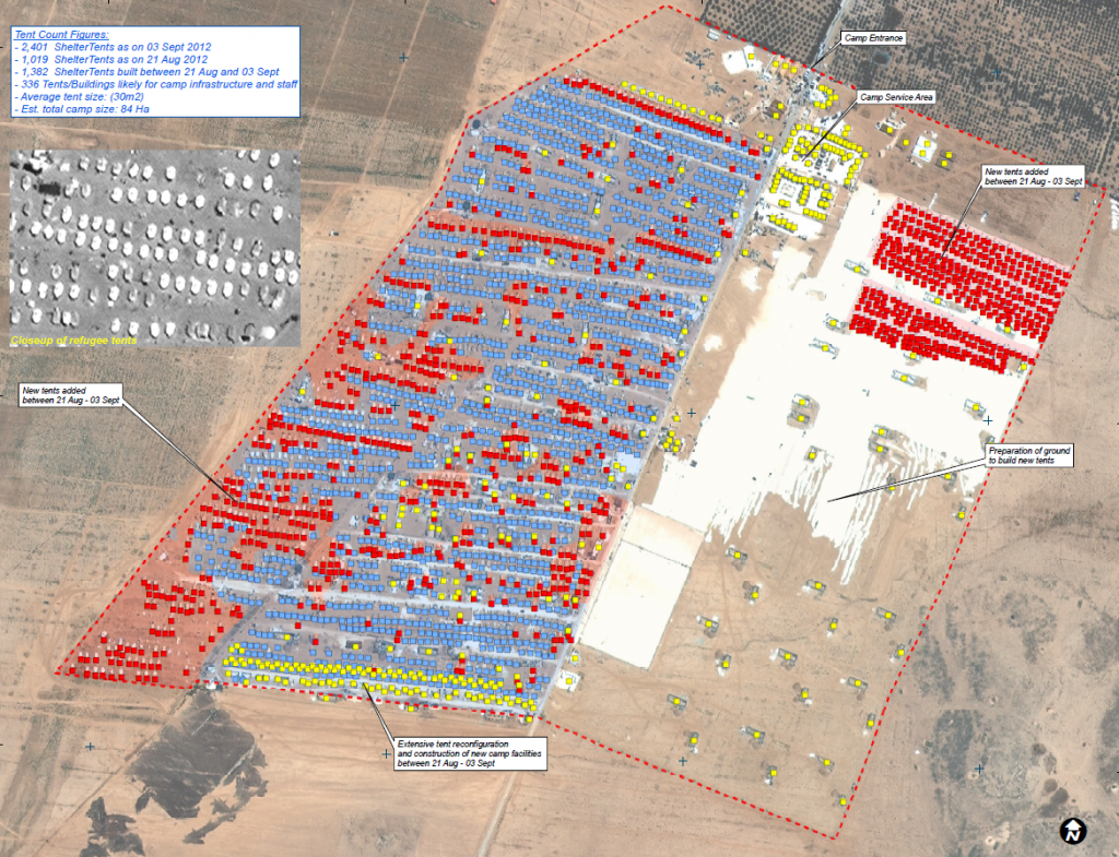
This map illustrates satellite-derived analysis and tents detections of Al Zaatri refugee camp in Mafraq Governorate, Northern Jordan. As of 03 September 2012, a total of approximately 2,400 tents and 336 camp building/tents structures were identified with a high degree of confidence within the well-defined and structured camp site encompassing a current area of approximately 84Ha. Of this total, 1,382 tents were likely erected for refugee people as on 21 August 2012. Between 21 August and 03 September, the camp expanded significantly in both size and capacity, adding over 1,019 tent shelters as well as a range of purpose-built structures likely dedicated for camp management. Tent shelters erected before 21 August 2012 were also extensively reorganized in several areas in order to build new tents. There was also ground prepared which could accommodate new tents over an area of approximately 30Ha.
Blue tents as of August 21, 2012.
Red tents as of September 3, 2012.
Yayladagi Camp Yayladagi District, Hatay Province, Turkey
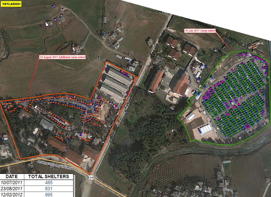
This map illustrates satellite-based area of refugee camp and tents detections in Hatay province of Turkey. No considerable changes in the organization (extension and number of tents) of Yayladagi camp were observed between 23 August 2011 and 12 February 2012. Around 65 new tents have been detected during this period. The most significant changes were observed between 10 July 2011 and 23 August 2011 when a new area was populated and around145 new tents were erected.
Green tents as of July 10, 2011.
Orange tents as of August 23, 2011.
Magenta tents as of February 12, 2012.
Reyhanli Camp Reyhanli District, Hatay Province, Turkey
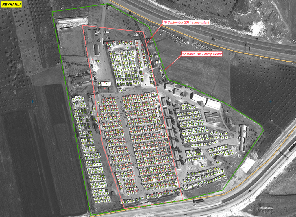
This map illustrates satellite-based areas of refugee camps and semi-automated tents detections in Reyhanli district, Hatay province of Turkey. Between 16 September 2011 and 12 Mars 2012 an extension of the camp in its limits as well as in the number of detected tents has been observed. Around 350 new tents have been detected between 16 September 2011 and 12 March 2012. This tends to show that the number of settled Syrian citizens in Turkey increases and fluctuates.
Pink tents as of September 16, 2011.
Green tents as of March 12, 2012.
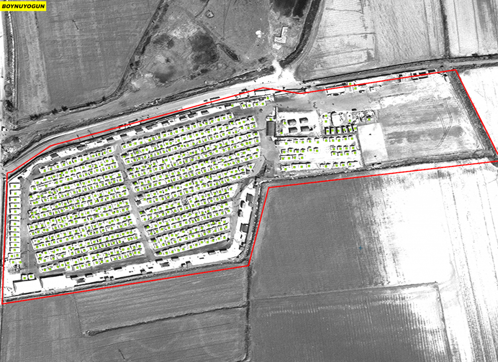
Boynuyogun Camp Merkez District, Hatay Province, Turkey
This map illustrates satellite-based area of refugee camp and semi-automated tents detections in Merkez district, Hatay province of Turkey. No considerable changes in the organization (extension and number of tents) of Boynuyogun camp were observed between images aquisition dates. Possibly due the proximity to the Syrian border and the governorate of Idleb.
Green tents as of March 12, 2012.
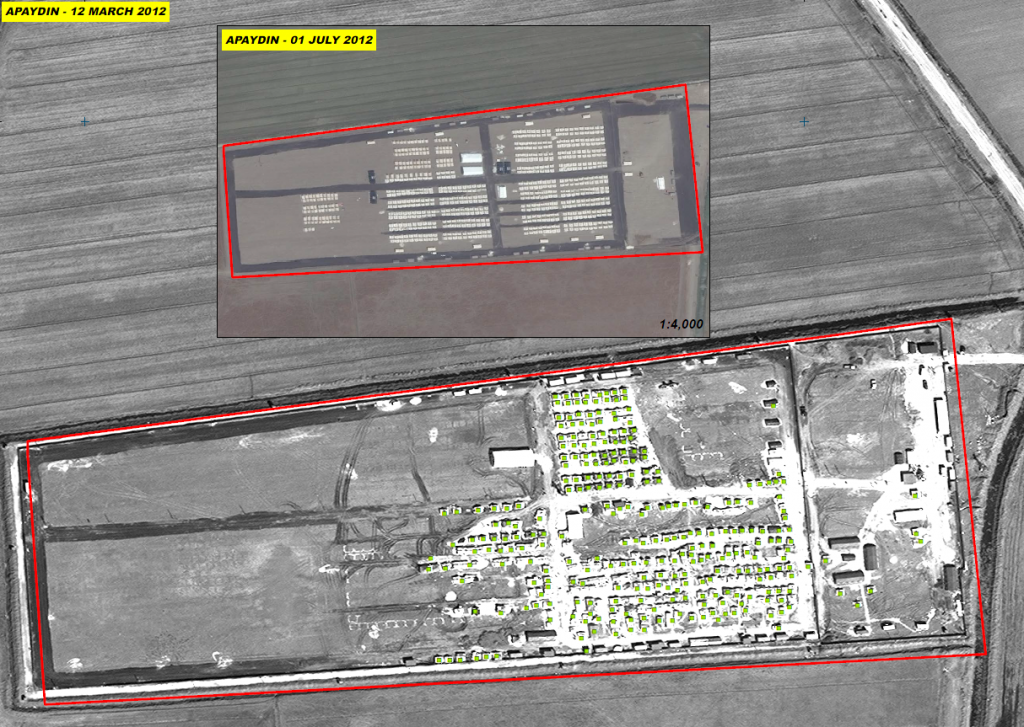
Apaydin Camp Merkez District, Hatay Province, Turkey
This map illustrates satellite-based area of refugee camp and semi-automated tents detections in Merkez district, Hatay province of Turkey. An activity has been detected within the Apaydin Camp where the number of tents was reduced. At least 400 tents were removed between 1 July 2011 and 12 March 2012. This change can be due to a new organization of camps or the fluctuation in the movements of the Syrian population in the Turkish camps.
Green tents as of March 12, 2012.

