Conflict Analysis: Zawiyah, Libya (as of 08 March 2011)
- 7 pages
- March 23, 2011
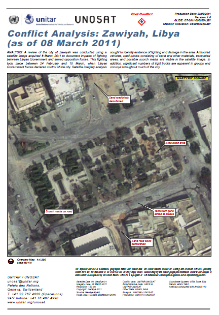
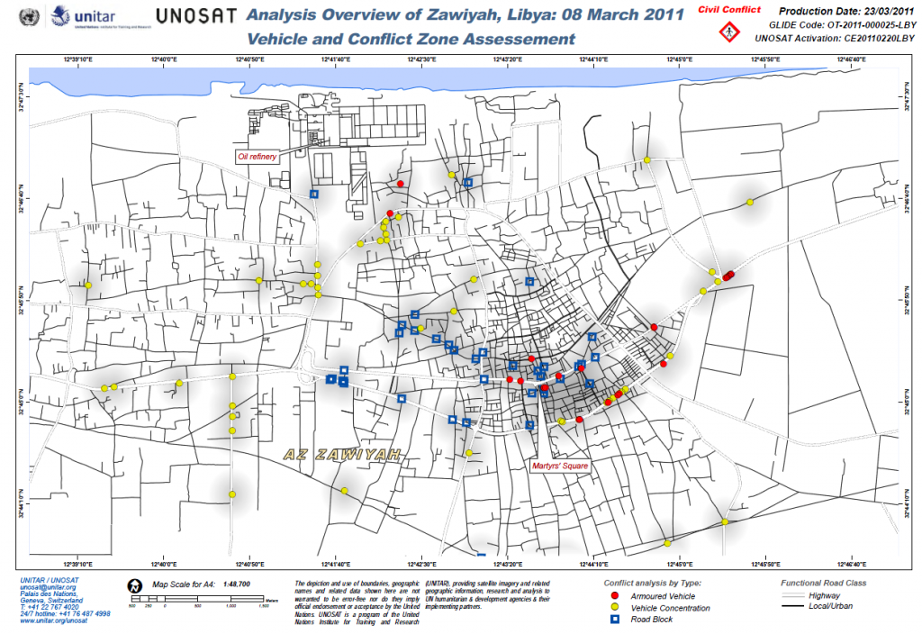
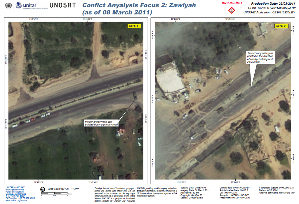
A review of the city of Zawiyah was conducted using a satellite image acquired 8 March 2011 to document impacts of fighting between Libyan Government and armed opposition forces. This fighting took place between 24 February and 10 March, when Libyan Government forces declared control of the city. Satellite imagery analysis sought to identify evidence of fighting and damage in the area. Armoured vehicles, road blocks consisting of sand and other materials, excavated areas, and possible scorch marks are visible in the satellite image. In addition, significant numbers of light trucks are apparent in groups and convoys throughout much of the city.
…


