DHS Office of Intelligence and Analysis
- 18 pages
- For Official Use Only
- July 15, 2011
(U) Interagency Remote Sensing Coordination Cell (IRSCC)
(U) Coordinate, synchronize, collaborate, and track remote sensing data acquisition activities and capabilities
(U) Ensure information needs of first responders, state emergency managers, and Federal are established and addressed;
(U) Establish an environment to facilitate awareness and share remote sensing data; and
(U) Improve the governance of Federal remote sensing operations by minimizing duplication of effort, unnecessary tasking, and by reducing operational costs…
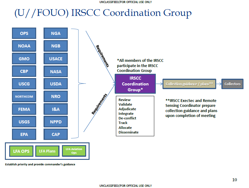
(U) IRSCC Members
Federal Emergency Management Agency
Office of Operations Coordination and Planning
Office Intelligence & Analysis
Customs & Border Protection
U.S. Coast Guard
Geospatial Management Office
National Protection and Program Directorate
U.S. Geological Survey
National Aeronautics & Space Administration
U.S. Department of Agriculture
National Oceanic & Atmospheric Administration
Environmental Protection Agency
U.S. Northern Command
National Guard Bureau
U.S. Army Corps of Engineers
National Geospatial-Intelligence Agency
National Reconnaissance Office
Civil Air Patrol…


