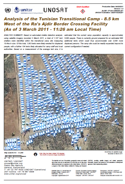
Analysis of the Tunisian Transitional Camp – 8.5 km West of the Ra’s Ajdir Border Crossing Facility (As of 3 March 2011 – 11:26 am Local Time)
- 4 pages
- March 3, 2011
ANALYSIS BACKGROUND: This is a satellite-based quantitative analysis of the newly-established transitional camp for displaced peoples fleeing the conflict in Libya, located along the southern side of highway route P1, 8.5 kilometers west of the Ra’s Ajdir border crossing facility in Ben Guerdane, Tunisia. This assessment provides an estimate of the number of tent shelters erected within the camp, the average approximate tent size, and the derived potential current population capacity, as based on satellite imagery recorded on the morning of 3 March 2011.
Two annotated maps of this analysis are included for reference (see pages 3-4). This report is part of an on-going satellite monitoring program of UNITAR/UNOSAT of the Libyan crisis in support of international humanitarian assistance and created to respond to the needs of UN agencies and their partners. Additional analytical reports and updates will be produced in the coming days based on new satellite imagery tasking and analysis.
…


