 European Union Satellite Centre
- COHU 1001 / N02 ISSUE 01
- 6 pages
- For Official Use Only
- © European Union Satellite Centre January 22, 2010
Introduction
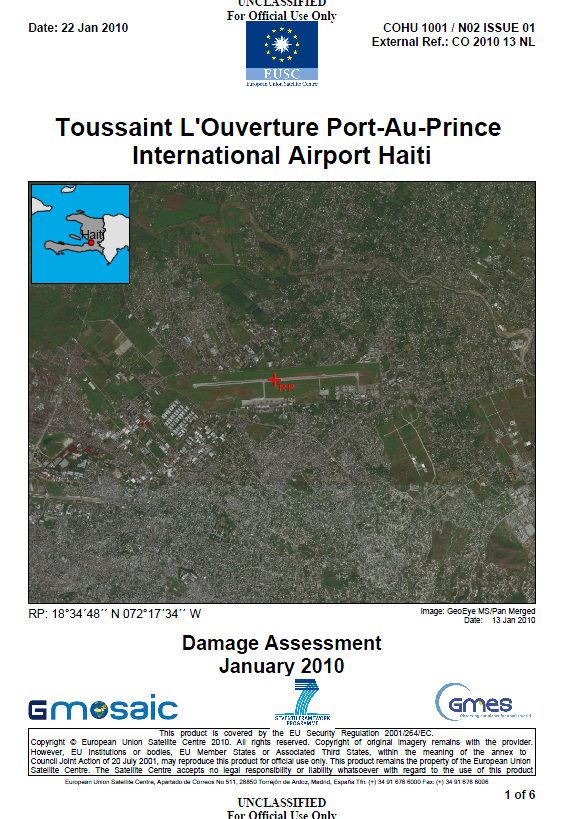
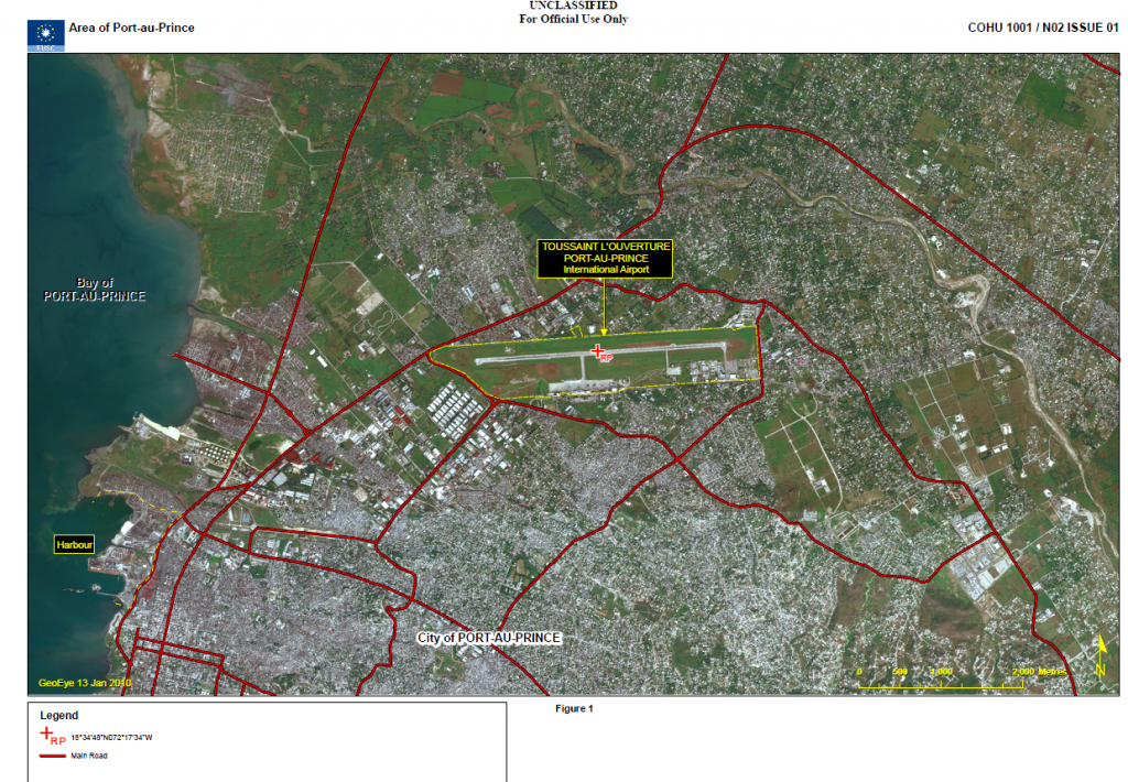
This briefing note covers Toussaint L´Ouverture, Port-au-Prince International Airport in Haiti and provides image analysis of the status, activity and facilities of the airfield with particular regard to any observed damage due to the recent earthquake. The note has been produced using a GeoEye multispectral image, dated 13 January 2010 which has been combined with open source collateral information. The information cut-off date of this briefing note is 22 January 2010.
1. Location and Type:
Reference Point (RP): RP: 18°34’48”N 072°17’34”W
International Airport2. Status
Permanent, serviceable, occupied and operational
3. Activity
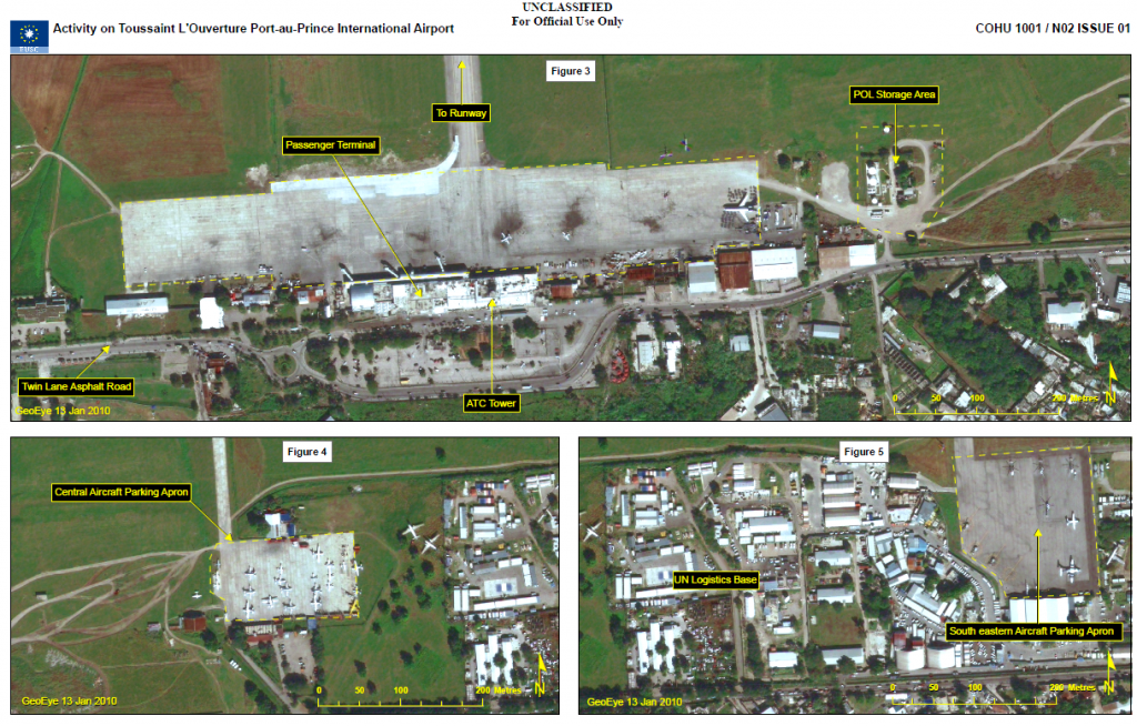
Aircraft activity included, two light helicopters, two executive jets and a single,
probably unserviceable Boeing 727 airliner observed on the passenger
terminal aircraft parking apron (Figure 3). On the grass area adjacent this, two
light transport helicopters were observed with their rotor turning. On the
central aircraft parking apron, 24 aircraft were observed. These comprised of
13 twin, propeller engine aircraft, 10 single, propeller engine aircraft, an
executive jet and three light helicopters (Figure 4). On the apron located to the
east of the UN Logistics Base (1) a Casa C212 Aviocar transport aircraft and
a Dash 7 transport aircraft were parked. In addition, four Mi 8/17 ´HIP`
transport helicopters and five UH-1N Iroquois transport helicopters were also
observed (Figure 5). Airborne and approaching the parking apron was a single
light helicopter.On the access roads leading to the airport vehicle traffic appeared to be
moving freely with no visible damage or obstructions on the roads. Ground
support equipment within the airport was also active.4. Defences
No air or ground defences were observed at the airfield or in the surrounding
area.5. Description of Facilities
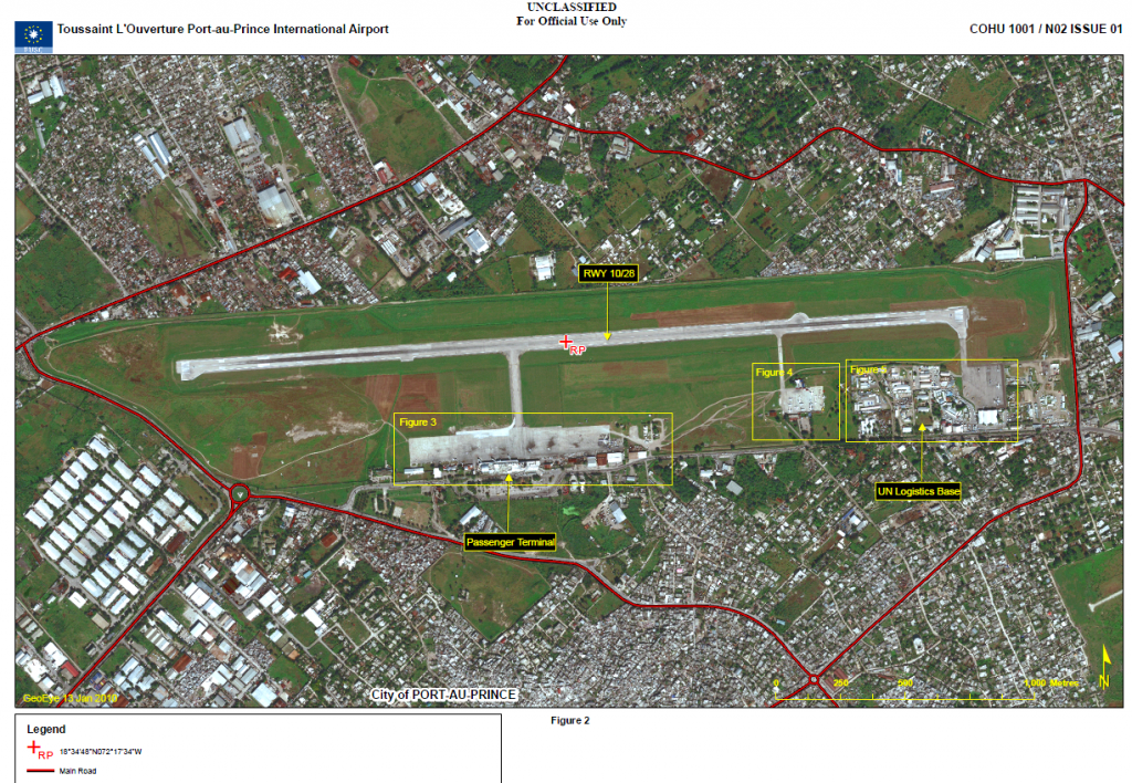
Toussaint L´Ouverture, Port-au-Prince International Airport has a single,
concrete runway known as RWY 10/28 with usable length of 3,000 m and a
width of 50 m. The runway has a turning area 650 m from the eastern end and
a second turning area at the western end. Three link taxiways connect the
runway to three aircraft parking aprons. These aprons comprise of a concrete
apron of 770 m by 110 m, in front of the airport passenger terminal (Figure 3),
a centrally located, concrete apron of 170 m by 100 m to the south of the
runway (Figure 4) and a concrete apron of 150 m by 160 m to the SE of the
runway (Figure 5).The passenger terminal is equipped with three passenger bridges and also
accommodates the air traffic control (ATC) tower on its roof. Adjacent to the
passenger terminal are numerous cargo transhipment buildings (Figure 3). To
the east of the passenger terminal is a POL storage area with three flat-roofed
POL storage tanks (Figure 3). In addition, a UN logistics base is contained in
a compound to the west of the south eastern aircraft parking apron. The
compound contains a hospital, numerous storage and support buildings and
vehicle parking areas occupied by light-toned UN vehicles (2) (Figure 5). The
airport navigation and landing aids include an ILS system and PAPI system at
the western end of the runway. The airport is partly wall and partly fencesecured
with watch towers and a perimeter patrol track. The main access to
the airport is via a twin lane asphalt road leading to the airport terminal.6. Damage Assessment
Although open source media reports have stated that the airport’s ATC tower
suffered damage during the earthquake and is not in use, no damage, such as
ground cracks or collapsed buildings and structures was visible on the image
of 13 January 2010. All of the aircraft operating areas and the internal roads
appear serviceable.…


