Tag Archive for National Geospatial-Intelligence Agency

Restricted U.S. Army Geospatial Intelligence Handbook

This training circular provides GEOINT guidance for commanders, staffs, trainers, engineers, and military intelligence personnel at all echelons. It forms the foundation for GEOINT doctrine development. It also serves as a reference for personnel who are developing doctrine; tactics, techniques, and procedures; materiel and force structure; and institutional and unit training for intelligence operations.

DHS Geospatial Concept of Operations (GeoCONOPS) Version 6

This Homeland Security (HLS) Geospatial Concept of Operations (GeoCONOPS) has been developed as a strategic starting point for understanding how the coordination of Homeland Security and Homeland Defense (HD) geospatial activities can be improved at the federal level. The intended audience for this document is the full geospatial community supporting the missions of the federal government under the National Response Framework (NRF) and Presidential Policy Directive 8 (PPD-8). This includes the stakeholders and actors representing the Emergency Support Functions (ESFs), the Joint Field Offices (JFO), Federal Operations Centers, the disaster preparedness exercise and evaluation community, and those involved in other NRF missions. Individuals representing these groups and activities have been extensively engaged in providing input for this document.

DHS Geospatial Concept of Operations (GeoCONOPS) Version 4

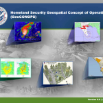
The Homeland Security Geospatial Concept of Operations (GeoCONOPS) provides an understanding of the current landscape for the coordination of disaster response geospatial activities at the Federal level. The document serves the geospatial communities that support emergency management activities of the Federal government under Presidential Policy Directive 8 (PPD-8). This includes individual Emergency Support Functions (ESFs), the Joint Field Offices, FEMA Regional Coordination Centers (RRCC), and the National Response Coordination Center (NRCC). Stakeholders and actors representing the federal geospatial community have been extensively engaged in providing input for the development of the GeoCONOPS document. The GeoCONOPS serves as a guide to the Federal departments and agencies providing geospatial support under the Stafford Act which defines the programs and processes by which the Federal Government provides disaster and emergency assistance to state and local governments, tribal nations, eligible private nonprofit organizations, and individuals affected by a declared major disaster or emergency.

(U//FOUO) DHS-FBI-NORTHCOM Super Bowl 2011 Joint Special Event Threat Assessment

This Joint Special Event Threat Assessment (JSETA) addresses potential threats to the National Football League (NFL)USPER Super Bowl XLV, which will be played on 6 February 2011 at Cowboys Stadium in Arlington, Texas. It focuses on potential threats to the game—and to various NFL-sanctioned events scheduled for the Dallas/Ft. Worth Metroplex-area during the 12 days prior to the game—from international and domestic terrorists, cyber actors, criminals, and foreign intelligence services.

Air Force Advanced Technical Exploitation Contract

Rapid and generally automated exploitation and reporting with adequate human intervention to produce actionable intelligence. This activity ranges from data processing to initial data interpretation to data posting for rapid dissemination/access across the community. It supports current intelligence issues and threats, warning/combat/crisis operations, and cueing other intelligence collectors.